LASER Scanner
How does the Laser Scanner perform measurements?
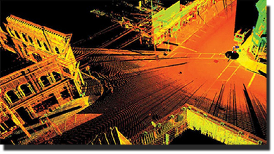
The Laser Scanner provides data points that includes “range” information (distance from scanner to scattering objects) including measurement of “return energy” or what we called as “Intensity”. The Laser Scanner then provides a detailed and accurate colored 3 Dimensional model of the scanned environment.The Laser Scanner can capture up to 800 million points, a 3D pixels with each pixel having X, Y and Z coordinates and color value. Laser Scanner emits a relatively low energy pulses within the infrared spectrum which is safe to human and biological environment.
Types of Infrastructure where LASER Scanner can be used
- Highway
- Urban Road
- Railway
- Coastal Zones
- and othersLASER Scanner Applications
- Nuclear Gas
- Oil & Gas
- Railway
- Water Industry
- Rivers and Canals
- Automotive
- Mining and Tunneling
- Heritage
- Architecture
- Accident Investigation
LASER Scanner Specification
- Active sensors that can be operated during night time with efficient data acquisition of 600,000 3D points per second.
- For data acquisition with vehicle moving at 20 to 30 km/h, improved point density better than 5 cm
- At no traffic constraints, data acquisition can be achieved at normal traffic speed up to 80km/h
- High Resolution Camera integration• High vegetation penetration because of its online waveform capabilities
2 SCANNERS
- Class 1 Laser Product according to IEC60825:2007 specification
- Online waveform processing 600,000 measurements per second
- Accuracy 5 mm
- Min. Range 1.5 m
- Max. Range 500 m
- GNSS/ INS:Accuracy (absolute) 10 – 50 mm
- Accuracy (relative) 5 mm
- Roll & Pitch 0.005
- Heading 0.015


